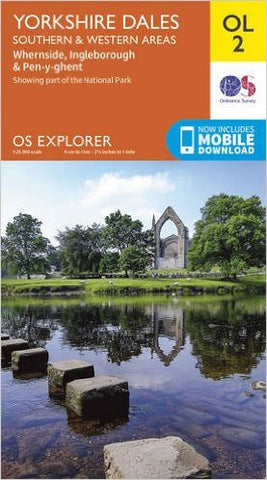
OS Explorer OL2 Yorkshire Dales - Southern & Western Areas
OS Explorer is the Ordnance Survey's most detailed map and is recommended for anyone enjoying outdoor activities like walking, horse riding and off-road cycling. The OS Explorer range of maps now includes a digital version of the paper map, accessed through the OS smartphone app, OS Maps. Providing complete GB coverage the series details essential information such as youth hostels, pubs and visitor information as well as rights of way, permissive paths and bridleways.
Organising a Yorkshire Three Peaks walk?
Help keep the Three Peaks special for all to enjoy by ensuring your walk is well planned, respects the environment and supports the local community. Here’s how:
- Let us know about your walk with our free notification scheme and receive our free Yorkshire Three Peaks Walk Guidelines. These guidelines will ‘point you in the right direction about what you need to organise and consider to ensure your walk minimises its impact and supports the area.
- Circulate the Yorkshire Three Peaks Code of Conduct to your group. These simple messages show what every individual can do to help keep the Three Peaks special for all to enjoy. Pass them on to everyone in your group.
- When you notify us of your event through our notification scheme you will receive a 10% discount on our Yorkshire Three Peaks merchandise.
What about adding one of these?..


